New Zealand Packrafting: Hollyford-Pyke Loop
By: Eszter Horanyi
I could feel tears welling up in my eyes as I struggled in the seemingly bottomless pit of mud, my heavily loaded packraft fallen to the side into some trees, my drysuit zipper, which had been unzipped for what was supposed to be an easy portage around a difficult rapid, covered in mud. In fact, my entire drysuit, which I’d half removed and tied around my waist, was now mud covered after I’d slipped and fallen while crossing the bog.

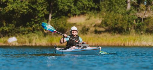
It was supposed to be an easy trip, the Hollyford-Pyke Loop (HPL) on the South Island of New Zealand. World famous in New Zealand, it’s a unique packrafting route that’s often touted as being downhill in both directions. Starting with a two-day float on the Hollyford River from the road-end at Gunn camp at the edge of Fiordlands down to the Tasman Sea, the route then follows the coast north for half a day before turning inland and crossing a small pass into the Pyke River drainage. The Pyke River, a tributary to the Hollyford River, completes the loop, and a quick two-hour hike upriver on a well-maintained track goes right back to the road-end. It’s brilliant really.
Since packrafting has taken off in New Zealand, the Hollyford-Pyke Loop has become the must-do trip, with most people taking five to six days to complete it. Commercial trips are guided on it, blog posts are dedicated to it, there are plenty of YouTube videos to watch to know exactly what the route entails.
So being covered in mud with a boat so heavy that I couldn’t actually carry it wasn’t exactly the situation I expected to find myself in. But as with everything in New Zealand, the moment you get cocky about anything, the place is sure to humble you.
My partner for the trip, Scott, and I had completed a three-day packrafting trip just a few days before embarking on the Hollyford-Pyke. It involved hiking over a mountain range, bush bashing through thick New Zealand rainforest, running difficult water, dealing with weather, and feeling very remote and out there. When it came to planning for the HPL, we hadn’t given the process our full attention. How difficult could it be? I tossed what I thought would be five days of luxurious eating for two people into bags and we headed to the road end.
When we completely mangled our put in and ended up trying to float a little side stream that we hoped would feed into the main river expediently (the Hollyford had rerouted itself during a massive flood several years ago and no longer flowed quite in front of the old boat ramp), I suspected that perhaps we were in trouble. Since we had planned for two days of floating before we’d have to carry our boats and gear, I’d packed all of the luxurious food. Five avocados, peppers, spinach, six ciders, plenty of chocolate, fancy pasta, gnocchi, and a whole host of other delicious, but heavy, food. But after our little side stream found itself in a mass of wood and we found ourselves carrying boats over gravel bars searching for a crystal-clear blue waters of the Hollyford, the excessive food seemed like entirely too much as I struggled to even lift my awkward boat off the ground, let alone carry it over the rocky ground.
Once on the water, and after getting over being thoroughly irritated with my mistake, as I was definitely the one who said, “I bet it’ll be fine,” things took a turn for the better. Benefiting from an absolutely gorgeous bluebird Fiordlands day, the river miles went quickly, the river snaking below the imposing Darran Mountains. Aside from the frequent tree in the river that required dodging, there was nothing to do but watch the world go by.

And that’s exactly what happened right up until the portage around the one difficult rapid on the route. Since the river is popular with jet boats, there’s a wide portage track cut through the brush around the rocky and technical section of whitewater. The entrance to the track was obvious, but as we stood at the water’s edge, there were two options. A wider track that went straight into a swamp, or a nice piece of singletrack. Having not done any research on what the correct route actually was, we stripped our drysuits halfway off for the walk and opted for the singletrack. And soon I found myself prone on the ground, completely covered in sticky, slimy mud. What should have been an easy 15-minute walk through the bush turned into a fairly miserable experience that had me questioning all of my outdoor skills and ability to deal with adversity in a graceful, mature, and adult manner.
And while I’ve hated some portages in my life, they all paled in comparison to this one. I’d never been so happy to put back on the water.
It was late evening when we finally made it to Lake McKerrow hut, and we were surprised to find it empty. It turned out to be a blessing that no one was around to witness the next hour where we emptied out our food bags only to find that a jar of pasta sauce had exploded, coating everything in tomato. The cleanup was extensive, and by the time we’d rinsed everything off, made ourselves dinner, and drank two of our six cans of cider, it was well past dark, something that happens very late right around summer solstice on the South Island. It was the perfect setup for a pre-first-light departure the next morning.

We were on the water as soon as we could see enough to navigate, incredulous that while there was wind, it was at our backs. Waves pushed us down the lake instead of hampering our progress. Knowing that the wind could change at any moment, we paddled steadily, getting across the lake and to the ocean and into the estuary in just under five hours. Martins Bay hut loomed majestic on the estuary shores.
Just 10 a.m., we were faced with a dilemma. It was early and the weather was good, so it seemed prudent to keep moving, transitioning to foot and walking north along the shore to Big Bay, but we had a problem. There was so much food packed away in our boats that we weren’t actually sure if we could fit everything into our packs. I had packed entirely too much to eat overall, none of it light, and now that we were already more than half a day ahead of schedule, the act of carrying it all on our backs seemed impossible.
We decided to stop, eat as much as we could, and reassess. Because really, Martins Bay was not going to be a bad place to wile away some time. Inhabited by Maori since the 1650s, it was discovered by Pakeha in 1861 and became a settlement intended as a port. It never panned out, and now the bay, known for its beauty and isolation, is a popular destination for trampers, boaters, and those looking to get away from it all for a few days. Helicopters and airplanes take advantage of the airstrip just inland.
We hauled our boats up to the stairs of the hut, which was still empty at this relatively early hour in the day. As someone who has often been described as impatient and wanting to do too much, I was still excited to go on after lunch and maybe a nap. But when the neck gasket of my drysuit ripped down to the seam as I was taking it off, our fate was sealed. We weren’t going anywhere until I could repair it with Aquaseal and let the glue set overnight. At least it made the decision easy, but I worried if my hack repair would actually work.
Settling into the spacious hut, with beds for more than 20 people, we started eating and drinking. Heavy food took priority, and since it was nearly noon, we cracked two more of the ciders. While food is a precious commodity on most packrafting trips, it became a burden on this one. After only a morning of paddling, and a big and late dinner the night before, there wasn’t the nagging hunger that is ever-present on most backcountry trips. Still, we ate what we could.

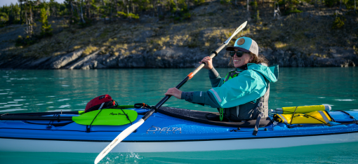
The day turned out to be a constant stream of what felt like planes, trains, and automobiles dropping people off in the bay. The only other self-powered group was a trio of women who’d taken sea kayaks down the Hollyford and were waiting for the crashing breakers to calm down so that they could paddle out into the ocean and back to Milford Sound where they all worked as kayak guides. There were many swims in the estuary throughout the heat of the day and wanders along the sand dunes and the shore.
And eating. There was so much eating. I was so tired of eating.
The sunset was absolutely stunning.
To try to beat the heat the following morning, we got up early, probably much to the chagrin of the two others who were sharing our bunk room with us. Maybe it’ll wake them up in time to enjoy the sunrise, I reasoned as I packed my bag, feeling only marginally guilty. My neck gasket fix seemed to be holding, so we struck off on foot up the coast, stopping to pay a visit to the resident seal colony just off the main track.
The well-established track soon turned overgrown as we made our way away from the hut. Nothing in New Zealand is ever as easy or straightforward as you want it to be, and while we’d done our best to eat as much as we could, the packs were still incredibly heavy, making the uneven track even more stumbly than it had to be. The rounded rocks along the shore made for slow going, but the ocean breakers quickly squashed any ideas of trying to paddle the stretch instead.

Soon we were at Big Bay, a small whitebait fishing community on the coast made up of a couple dozen small huts only accessible by boat, helicopter, or plane. Still before Christmas, it was abandoned and quiet as we made our way through and towards the Pyke River, skipping a stay at the Big Bay hut and hoping to make it to the next hut on the route before dark. While the distance wasn’t great and the elevation gain wasn’t significant, the incredibly heavy packs hampered progress. The heat, so unusual for Fiordlands, was oppressive. My feet started to suffer.
Clouds moved in as we got to the banks of the Pyke River, confirming that the last weather forecast that we’d looked at before leaving civilization was probably going to be correct, and we were going to get rained on sooner rather than later. We weren’t surprised at the prospect of getting wet, the Fiordlands are the rainiest part of the country after all, the rainforest thriving on seven meters of rainfall a year.
But for now, it was just clouds, so we donned drysuits, transitioned to floating mode, and put our boats on what seemed like the clearest water in New Zealand. It felt like flying over the river rocks, the water invisible, the swift little stream carrying boats like a magic carpet. Deep pools were filled with native eels and giant beech trees towered overhead. Much too far from the hut to make it by nightfall, there was no urgency to paddle and try to get somewhere specific. Instead, we floated lazily along, mesmerized by the movement of the rocks underneath the boats, the birds singing in the trees, and the general magical feeling of this river valley that felt like it was at the end of the earth.

Eventually we set up camp on a gravel bar, enjoying watching the clouds change color as the sun set. The main walking part of the trip was over and there wasn’t any more pressure to eat as much as possible. While I never thought I’d say I’d be relieved to not have to eat everything that would fit into my belly on a backcountry trip, I was relieved to not have to eat everything that would fit into my belly.
We woke to clouds in the morning and continued down the Pyke, crossing first Lake Wilmot and then Lake Albatross. Storms unleashed both in front of us and behind, and we kept rain jackets at the ready, figuring that we’d get hammered eventually.
But Huey, the New Zealand god of weather and wind, took mercy on us, not unleashing the rain and wind until we were out of the boats, packed up, and happily walking down the track towards Hidden Falls hut. And then it rained, in buckets, in true Fiordland style. But with packs that weighed nothing compared to what we started with, and only one more night out before a quick jaunt back to the car in the morning, we were unfussed by the rain.
Until we got to the hut and found it full, every bunk accounted for, and maybe even some of the floor space. Disappointment set in at first as we contemplated walking the final two hours back to the car in the rain, finishing off the trip a day early. It would have been a fairly anticlimactic end to a trip that had started out rough but had continued to prove itself worth the effort with unending beauty. But there was a porch, a big one that wrapped all the way around the hut, and one side was completely protected from the weather and still bone dry. It didn’t take much convincing for us to set up our tent haphazardly on the wooden planks and set our soaking clothes out to dry on the handrails. We cooked dinner under high peaks shrouded by clouds watching the clouds move through the valley.

Even four nights into the trip, we still had plenty of delicious food to fill our bellies with. And with the struggles of the first day’s portage and the second day’s over-eating requirement long in the rearview mirror of memories, we relished the meal, the location, and even the weather. A true taste of Fiordlands.
The next morning, under raging waterfalls, we walked the final kilometers back to the car, laughing at the absurdity of our attempted put in location five days prior. Our lack of research may have resulted in some struggle and poor decisions, but in the end, the sheer beauty of the trip outweighed any of the misery.
But I will say, when I do the trip again, I’ll definitely go a little bit lighter on food, even if the first two days are just floating.